

Founder and Managing Partner
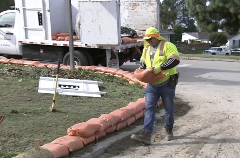
Evacuation orders and warnings are in effect for portions of Southern California as the region braces for a winter storm that’s expected to bring heavy rain and widespread flooding.
“People need to start preparing now for a major flooding event,” National Weather Service forecasters warned.
In anticipation of such events, areas that have seen damaging flooding during past storms are gearing up. Here’s a breakdown of evacuation orders and warnings currently in effect:
Ventura County evacuations
Mandatory evacuations were ordered for residents in the unincorporated Ojai area, including Matilija Canyon, North Fork and Camino Cielo.
Evacuation warnings were issued for the following areas:
- Ventura RV Resort
- Community of Foster Park/Camp Chaffee
- Old Creek Road
- Structures on Grada Avenue and Truelo Avenue in unincorporated Camarillo
Evacuation warnings and orders are in effect for parts of Ventura County as a storm moves into the region, bring the risk of dangerous flooding.
Topanga Canyon evacuations
An evacuation order was issued for areas along Santa Maria Road north of Topanga Canyon due to high risk of mud and debris flows. The order will remain in effect until 6 p.m. Tuesday.
Meanwhile, evacuation warnings have been issued for several unincorporated parts of L.A. County near the Agua Fire, Bobcat Fire (specifically the north end), Lake Fire and Owen Fire burn scars. See more information on the warnings here.
All evacuation warnings will be in effect starting 10 a.m. Sunday through 6 p.m. Tuesday.
Santa Maria Road evacuations
Officials issued an evacuation order for residents living on Santa Maria Road to Topanga Canyon due to the high risk of mud or debris flows in the area.
Evacuation orders were also issued for the Owen Fire and Agua Fire burn areas.
La Tuna Canyon evacuations
An evacuation warning was upgraded to a mandatory order for residents along La Tuna Canyon Road in Sun Valley. The affected area encompasses Horse Haven to the north, Martindale to the east, Primrose to the south and Ledge to the west.
Several evacuation centers have been established.
Santa Barbara County evacuations
Evacuation orders are in place in several parts of Santa Barbara. Officials are ordering people in those areas to leave by 2 p.m. Sunday.
The evacuation areas include areas along waterways associated with the Thomas, Cave and Alisal burn areas and properties in the vicinity of Sycamore Creek, from Stanwood Drive down to parts of Ninos Drive, in the city of Santa Barbara. The incoming storm has the potential to produce flash flooding, debris flows and landslides.
L.A. County burn scar area evacuations
Evacuation warnings were issued for areas of unincorporated L.A.
Duarte evacuations
An evacuation warning will go into effect for some residents around the Fish Fire burn scar area in Duarte. The order will go into effect at 6 p.m. Sunday for residents on Melcanyon Road between Brookridge Road and Fish Canyon Road.
The warning will be in place through 10 a.m. Tuesday.
How much is it going to rain?
The multiple-day storm could drop 3 to 6 inches of rain in coastal and valley areas, and 6 to 12 inches in the mountains, with much of that downpour occurring in a 24- to 36-hour period between Sunday into Monday, the NWS said.
“Historically, rainfall of this magnitude creates major hydrologic problems in our area and there’s no reason to think this won’t happen with this event,” forecasters said.
The heavy rain will be accompanied by strong winds in many areas, blowing at speeds of 30 to 50 mph in parts of L.A. County, and reaching up to 60 to 80 mph in higher mountain areas and the Golden State (5) Freeway corridor.
As the storm moves slowly toward the Southland from the north, rain will fall across most of the region Sunday, arriving in the L.A. area by Sunday night.
A flood watch will be in effect from Sunday afternoon through Tuesday afternoon for Los Angeles County.
“Given the sheer amounts of rainfall expected in the time period, the 3-6 hour rain rates could be problematic, exceeding USGS thresholds which could lead to mud/debris flow issues as well as swift water rescues in the local rivers and streams,” the NWS said.